")
Gravity-wave spatial, temporal and spectral distribution
A useful synthesis of available measurements in a consistent picture could be aided by a GW permitting non-hydrostatic global atmosphere model with a local refinement option to almost GW resolving. Even such a model, however, has limitations. Many source processes are based on imprecise subgrid-scale (SGS) parameterizations, the model resolution would not be able to handle turbulent GW dissipation explicitly, and the model’s discretization errors will influence its dynamics at the smallest resolved scales. Either measurements or GW-permitting modeling alone would have limited value. Best confidence can be reached by validating a model against measurements. Combining measurements from a campaign seems interesting, since then the validation will cover a wider spectral range and several locations. Such a validation has to be performed for a specific meteorological situation, requiring that the model be initialized with assimilated data, as in numerical weather prediction (NWP). Good agreement between model and observations in such a situation increases confidence in the model treatment of source processes and propagation. Validation against global satellite-data statistics represents a supplementary check. The validated model can then be used as a practical, comprehensive test bed for theoretical developments. Needless to say that model improvements, spurned by disagreements between model and observations, will further enhance the synthesis provided by the model. Such developments will constitute the iterative process of learning in the RU. This leads to the following sub-objectives:
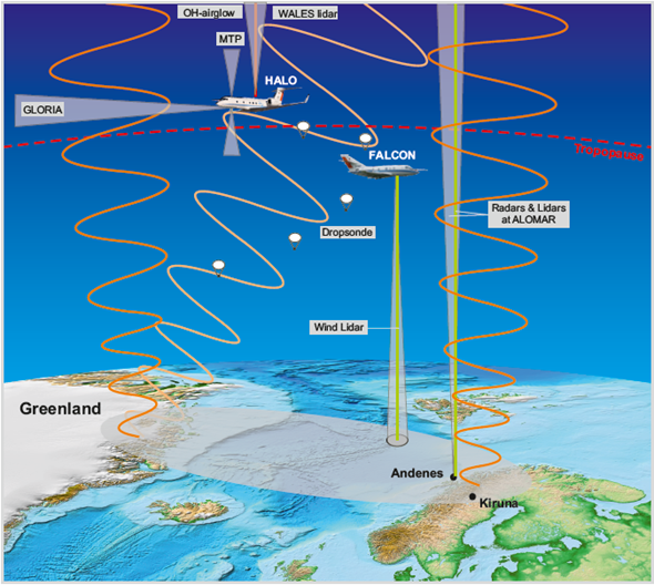
► D1: Analysis of new and already existing atmospheric measurements and weather-service data of the GW distribution (contributing projects: PACOG, SV, GW-TP):


- Time-dependent vertical profiles of GW winds and temperatures at selected horizontal lidar and radar locations.
- Horizontal profiles along selected aircraft trajectories.
- Global horizontal maps of GW properties in layers accessible to satellite sounding.
- Combination of such measurements in campaigns in selected episodes.
- Cross-comparisons of these measurements.
► D2: Development of a GW permitting global model with the following properties (contributing projects: GWING, SV, GW-TP, SI, 3DMSD):
- Non-hydrostatic formulation.
- Altitude range from the ground to the lower thermosphere.
- Potential for global high resolution (GW permitting)
- Potential for local refinement to extremely high resolution (horizontal scale a few km, vertical scale a few 100m).
- Potential for initialization with operationally assimilated data.
- Parameterization of subgrid-scale GWs, at least in the non-refined regions.
► D3: Validation of the GWs simulated by the model, by comparisons with available measurements and other models (contributing projects: GWING, PACOG, SV, GW-TP, 3DMSD):
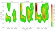
- Validation against GW climatologies from satellites, and at selected horizontal locations.
- Validation against campaign data.
- Validation against spectra from GW permitting idealized models.